UKK Trail — Hyrynsalmi section


Route


Description
The UKK-reitti is Finland’s national long-distance hiking route named after President Urho Kaleva Kekkonen; the full network runs hundreds of kilometres across eastern and northern Finland. Trekkari describes how regional planners linked Vuokatti and Koli in the 1980s and how marking and maintenance vary along differen...
Managed by
Hyrynsalmi
Official Maintenance
Trail info
Walked both ways on the national line; many day visitors describe the Ukkohalla–Hyrynsalmi centre direction as gentler downhill overall, while the full 40 km through-hike is often planned north-to-south or south-to-north to match transport.
Route direction
Blue paint on tree trunks along the UKK line in this region; local listings describe blue markings for adjoining Kainuu sections.
Route Signs
Open / Good Condition
Open / Good Condition
Activities allowed
Hike / Walk
Activity
Terrain & conditions
40.5 km
Distance
About 10–14 hours as one long day for fit hikers; or two comfortable days with breaks at laavut and fire sites.
Est. Time
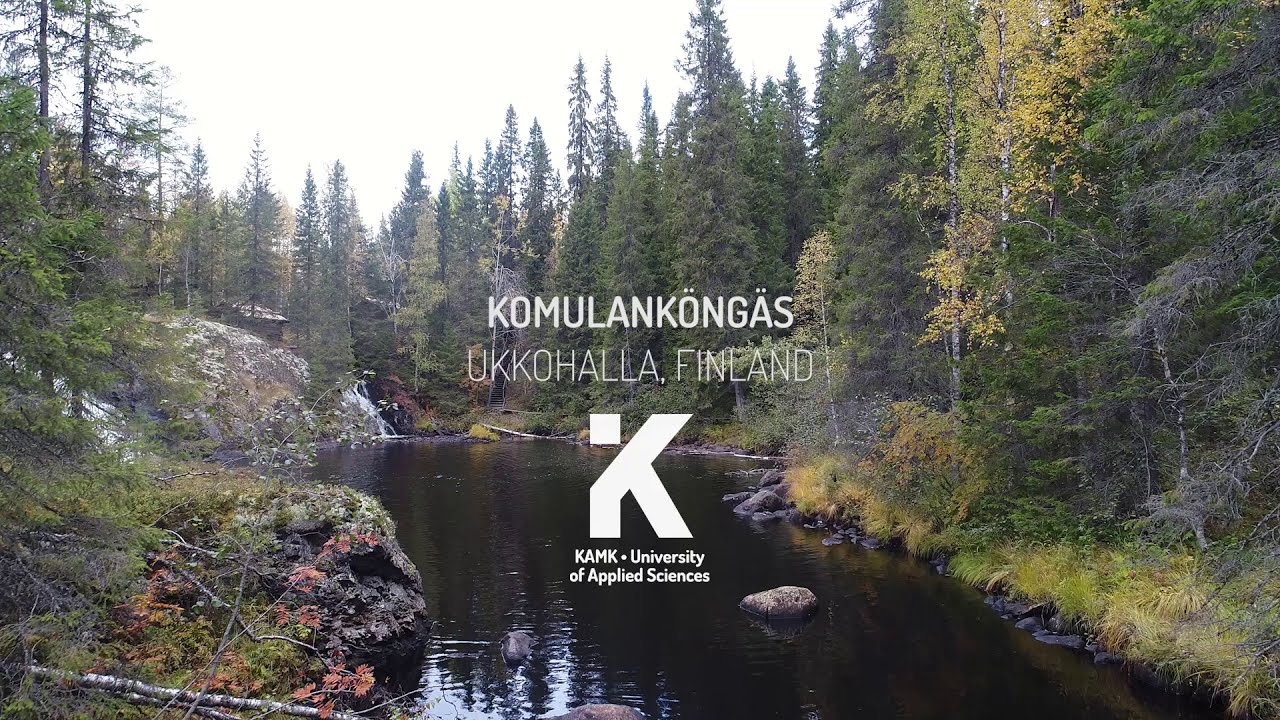
Forest paths and gravel tracks with riverbank sections, duckboards and stairs at Komulanköngäs, roots and rocky stretches in Vorlokki ravine terrain; occasional short road links.
Surface
Point-to-Point, Single Track
Route Type
Light Traffic
Traffic
Partial Shade
Shade
Location
64.75184°N, 28.09375°E
Parking coordinates

Rate & Review
Be the first to write a review for "UKK Trail — Hyrynsalmi section"
Share a photo from a recent trip
Answers to your questions
CC BY-NDTaru Kemppainen, Outdoors Kainuu
Our data was researched from Hyrynsalmi, and other trusted sources, in March 2026. Our route / place GPX data comes from Metsähallitus / Lipas, last updated March 2026. Always check their official website for safety-critical updates.
UKK Trail — Hyrynsalmi section40.5 km
Route
Video
Videos
Description
The UKK-reitti is Finland’s national long-distance hiking route named after President Urho Kaleva Kekkonen; the full network runs hundreds of kilometres across eastern and northern Finland. Trekkari describes how regional planners linked Vuokatti and Koli in the 1980s and how marking and maintenance vary along differen...
Managed by
Hyrynsalmi
Official Maintenance
Trail info
Location
Walked both ways on the national line; many day visitors describe the Ukkohalla–Hyrynsalmi centre direction as gentler downhill overall, while the full 40 km through-hike is often planned north-to-south or south-to-north to match transport.
Route direction
Blue paint on tree trunks along the UKK line in this region; local listings describe blue markings for adjoining Kainuu sections.
Route Signs
Open / Good Condition
Open / Good Condition
Location
64.75184°N, 28.09375°E
Parking coordinates
Activities allowed
Hike / Walk
Activity
Terrain & conditions
40.5 km
Distance
About 10–14 hours as one long day for fit hikers; or two comfortable days with breaks at laavut and fire sites.
Est. Time
Forest paths and gravel tracks with riverbank sections, duckboards and stairs at Komulanköngäs, roots and rocky stretches in Vorlokki ravine terrain; occasional short road links.
Surface
Point-to-Point, Single Track
Route Type
Light Traffic
Traffic
Partial Shade
Shade
Rate & Review
Be the first to write a review for "UKK Trail — Hyrynsalmi section"
Share a photo from a recent trip
Answers to your questions
CC BY-NDTaru Kemppainen, Outdoors Kainuu
Our data was researched from Hyrynsalmi, and other trusted sources, in March 2026. Our route / place GPX data comes from Metsähallitus / Lipas, last updated March 2026. Always check their official website for safety-critical updates.