For how the Open Fell Biking backbone links Kakslauttanen, Kiilopää, Saariselkä village, and Moitakuru—and how numbered loops 1–7 are posted in the terrain with maps and GPS downloads—start with the Municipality of Inari’s mountain biking pages. Lapland North Destinations sums up summer and winter cycling across nor...
Inari.fi – Maastopyöräily Inarissa+
Description
For how the Open Fell Biking backbone links Kakslauttanen, Kiilopää, Saariselkä village, and Moitakuru—and how numbered loops 1–7 are posted in the terrain with maps and GPS downloads—start with the Municipality of Inari’s mountain biking pages. Lapland North Destinations sums up summer and winter cycling across northernmost Lapland, including Kiilopää and Saariselkä, and points you toward rentals and activity desks.
This ride is about 10.5 km as one point-to-point leg on that spine, aimed at people who want a manageable distance between the Kakslauttanen parking belt and Kiilopää’s service cluster without committing to a full-day loop. Early on you reach Kakslauttanen Parkkipaikka; roughly mid-route, Ravintola Tuisku sits conveniently for a warm drink or meal. The Kiilopää end gathers Kiilopään Kuurakaltio, Kiilopään uimapaikka, the Kiilo-oja campfire site, Kiilopään frisbeegolfrata, Kiilopää pysäköintialue, and Suomen Latu Kiilopää’s café and restaurant within a short roll of one another—easy to turn the ride into a sauna-and-food finish or a shuttle pickup. The Finnish name reflects the Muotkanmaja waypoint on local OFB materials for this forest-and-fell corridor between Kakslauttanen and Kiilopää.
Expect mixed forest tracks and wider connectors typical of the Saariselkä–Kiilopää network; after rain, needles and soil can soften quickly. Inside Urho Kekkonen National Park, ride only where bicycles are allowed—Luontoon.fi hosts the official UKK cycling guidance—and yield to other visitors. Roll Outdoors recommends full-suspension or fatbike equipment for Lapland surfaces, with a hardtail acceptable on mellower linked sections if you already ride confidently. Suomen Latu’s Kiilopää pages highlight marked trails, rental bikes, wash and service basics, free e-bike charging, and a broad overview clip of cycling inside UKK.
You can splice this leg into the longer Saariselän maastopyöräilyreitit network when you want additional distance or alternate return options.
Length & route
About 10.5 km point-to-point on the Open Fell Biking backbone between the Kakslauttanen and Kiilopää service areas. Treat distance as the registered trail length; some community ride descriptions stitch longer loops if you return along other marked legs.
Getting there
Snow-free riding in the Saariselkä–Kiilopää area usually runs from about June through the end of October; confirm weather and trail status before leaving. You can begin from Kakslauttanen Parkkipaikka or finish at Kiilopää pysäköintialue and arrange a shuttle. Printed OFB maps are handed out free at local businesses and tourist information, with digital GPX bundles linked from municipal and tourism partners.
Good to know
Trail etiquette in the fells means controlled speed, packing out waste, and staying on posted cycling corridors inside the national park. Winter riding uses separately maintained networks; do not assume this summer spine is groomed when the snow arrives. Campfire use at Kiilo-oja follows everyman’s rights, fire warnings, and any posted firewood guidance.
History
Municipal materials describe EU-funded development that branded Open Fell Biking, produced cartography, and expanded cyclist services while Metsähallitus crews marked cycling routes across Saariselkä terrain in summer 2021.
Where to rent bikes
Lapland North Destinations lists rental partners such as Kiilopää Adventures at Kiilopää, Saariselkä Ski & Sport Resort, Outdoor Expert Saariselkä, Paadar Aurora Villas, and other desks supplying mountain bikes, e-bikes, and fatbikes with advance booking advised in peak season. Roll Outdoors markets full-suspension, fatbike, and kids’ hire for the Saariselkä–Kiilopää area when its Kiilopää base is open. Kiilopää’s own rental desk also offers MTBs, fatbikes, and e-bikes plus helmets and packs.
Guided tours & Experiences
Roll Outdoors and other Lapland North Destinations partners post guided mountain bike departures when seasonal; check calendars before travel.
Point-to-point as mapped from the Kakslauttanen parking side toward Kiilopää; you can ride either direction or link other OFB segments for a round trip.
Route direction
Open Fell Biking loops 1–7 use symbol-and-number posts with map checks. Treat this backbone segment as part of the same marked network and carry the latest municipal or tourism map.
Route Signs
Dogs (On Leash)
Dogs
Open / Good Condition
Inari.fi – Maastopyöräily Inarissa
Activities allowed
Hike / Walk
Activity
Bike
Activity
Terrain & conditions
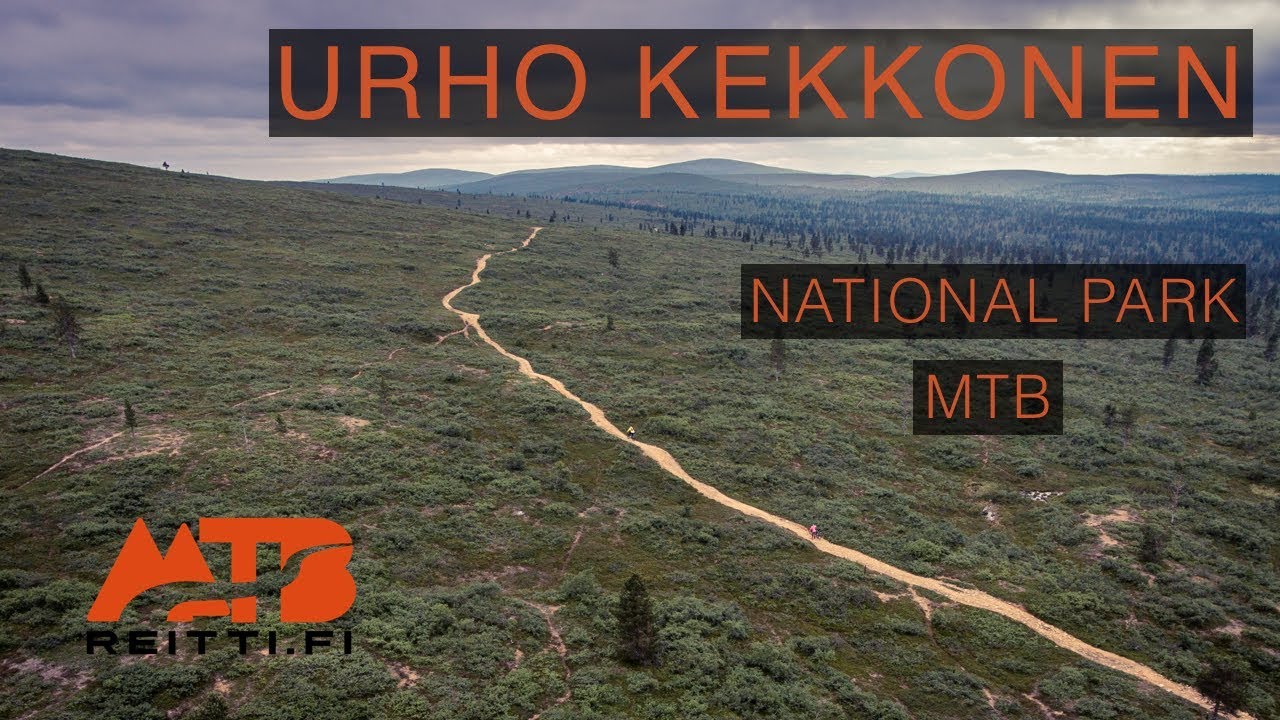
10.5 km
Distance
Roughly one to two hours of pedalling for fit adults without long stops; longer with meals at Ravintola Tuisku or Suomen Latu Kiilopää.
Est. Time
Mixed needle-floor forest trail and gravel connectors on the Saariselkä–Kiilopää spine; short sections can feel narrow between wider forest road legs.
Be the first to write a review for "Kiilopää–Kakslauttanen–Muotkanmaja bike route"
Share a photo from a recent trip
Answers to your questions
Our data was researched from Sodankylä, and other trusted sources, in March 2026. Our route / place GPX data comes from Metsähallitus / Lipas, last updated March 2026. Always check their official website for safety-critical updates.
MTBreitti’s UKK-wide mountain biking overview—useful for terrain and pacing expectations before heading out, not a turn-by-turn of this short spine leg.
Description
For how the Open Fell Biking backbone links Kakslauttanen, Kiilopää, Saariselkä village, and Moitakuru—and how numbered loops 1–7 are posted in the terrain with maps and GPS downloads—start with the Municipality of Inari’s mountain biking pages. Lapland North Destinations sums up summer and winter cycling across nor...
Inari.fi – Maastopyöräily Inarissa+
Description
For how the Open Fell Biking backbone links Kakslauttanen, Kiilopää, Saariselkä village, and Moitakuru—and how numbered loops 1–7 are posted in the terrain with maps and GPS downloads—start with the Municipality of Inari’s mountain biking pages. Lapland North Destinations sums up summer and winter cycling across northernmost Lapland, including Kiilopää and Saariselkä, and points you toward rentals and activity desks.
This ride is about 10.5 km as one point-to-point leg on that spine, aimed at people who want a manageable distance between the Kakslauttanen parking belt and Kiilopää’s service cluster without committing to a full-day loop. Early on you reach Kakslauttanen Parkkipaikka; roughly mid-route, Ravintola Tuisku sits conveniently for a warm drink or meal. The Kiilopää end gathers Kiilopään Kuurakaltio, Kiilopään uimapaikka, the Kiilo-oja campfire site, Kiilopään frisbeegolfrata, Kiilopää pysäköintialue, and Suomen Latu Kiilopää’s café and restaurant within a short roll of one another—easy to turn the ride into a sauna-and-food finish or a shuttle pickup. The Finnish name reflects the Muotkanmaja waypoint on local OFB materials for this forest-and-fell corridor between Kakslauttanen and Kiilopää.
Expect mixed forest tracks and wider connectors typical of the Saariselkä–Kiilopää network; after rain, needles and soil can soften quickly. Inside Urho Kekkonen National Park, ride only where bicycles are allowed—Luontoon.fi hosts the official UKK cycling guidance—and yield to other visitors. Roll Outdoors recommends full-suspension or fatbike equipment for Lapland surfaces, with a hardtail acceptable on mellower linked sections if you already ride confidently. Suomen Latu’s Kiilopää pages highlight marked trails, rental bikes, wash and service basics, free e-bike charging, and a broad overview clip of cycling inside UKK.
You can splice this leg into the longer Saariselän maastopyöräilyreitit network when you want additional distance or alternate return options.
Length & route
About 10.5 km point-to-point on the Open Fell Biking backbone between the Kakslauttanen and Kiilopää service areas. Treat distance as the registered trail length; some community ride descriptions stitch longer loops if you return along other marked legs.
Getting there
Snow-free riding in the Saariselkä–Kiilopää area usually runs from about June through the end of October; confirm weather and trail status before leaving. You can begin from Kakslauttanen Parkkipaikka or finish at Kiilopää pysäköintialue and arrange a shuttle. Printed OFB maps are handed out free at local businesses and tourist information, with digital GPX bundles linked from municipal and tourism partners.
Good to know
Trail etiquette in the fells means controlled speed, packing out waste, and staying on posted cycling corridors inside the national park. Winter riding uses separately maintained networks; do not assume this summer spine is groomed when the snow arrives. Campfire use at Kiilo-oja follows everyman’s rights, fire warnings, and any posted firewood guidance.
History
Municipal materials describe EU-funded development that branded Open Fell Biking, produced cartography, and expanded cyclist services while Metsähallitus crews marked cycling routes across Saariselkä terrain in summer 2021.
Where to rent bikes
Lapland North Destinations lists rental partners such as Kiilopää Adventures at Kiilopää, Saariselkä Ski & Sport Resort, Outdoor Expert Saariselkä, Paadar Aurora Villas, and other desks supplying mountain bikes, e-bikes, and fatbikes with advance booking advised in peak season. Roll Outdoors markets full-suspension, fatbike, and kids’ hire for the Saariselkä–Kiilopää area when its Kiilopää base is open. Kiilopää’s own rental desk also offers MTBs, fatbikes, and e-bikes plus helmets and packs.
Guided tours & Experiences
Roll Outdoors and other Lapland North Destinations partners post guided mountain bike departures when seasonal; check calendars before travel.
Point-to-point as mapped from the Kakslauttanen parking side toward Kiilopää; you can ride either direction or link other OFB segments for a round trip.
Route direction
Open Fell Biking loops 1–7 use symbol-and-number posts with map checks. Treat this backbone segment as part of the same marked network and carry the latest municipal or tourism map.
Roughly one to two hours of pedalling for fit adults without long stops; longer with meals at Ravintola Tuisku or Suomen Latu Kiilopää.
Est. Time
Mixed needle-floor forest trail and gravel connectors on the Saariselkä–Kiilopää spine; short sections can feel narrow between wider forest road legs.
Surface
Wide Track
Route Type
Light Traffic
Traffic
Partial Shade
Shade
Rate & Review
Be the first to write a review for "Kiilopää–Kakslauttanen–Muotkanmaja bike route"
Share a photo from a recent trip
Answers to your questions
Our data was researched from Sodankylä, and other trusted sources, in March 2026. Our route / place GPX data comes from Metsähallitus / Lipas, last updated March 2026. Always check their official website for safety-critical updates.