For how Open Fell Biking connects Kiilopää with the wider Saariselkä trail spine, how numbered loops and maps are published, and where to download GPX bundles, start with the Municipality of Inari's mountain biking pages. Lapland North Destinations rounds up summer and winter cycling services, rentals, and activity...
Inari.fi – Maastopyöräily Inarissa+
Description
For how Open Fell Biking connects Kiilopää with the wider Saariselkä trail spine, how numbered loops and maps are published, and where to download GPX bundles, start with the Municipality of Inari's mountain biking pages. Lapland North Destinations rounds up summer and winter cycling services, rentals, and activity desks across northernmost Lapland.
Sivakkaoja is a point-to-point ride of about 11.7 km between the Kiilopää service cluster and the Niilanpää area, aimed at riders who want a shorter, approachable leg through forest and gentle furrow terrain rather than a full-day loop. Leaving Kiilopää you quickly pass Kiilopää pysäköintialue, Suomen Latu Kiilopää - Kahvila & Ravintola, Kiilopään frisbeegolfrata, Kiilo-oja tulipaikka, Kiilopään uimapaikka, and Kiilopään Kuurakaltio within a few hundred metres of one another—easy to combine with food, a swim, or equipment rental before you commit to the forest section. Roughly 2.8 km along the line, Sivakkaojan laavu and the nearby Sivakkaoja käymälä make a natural lunch stop in Urho Kekkonen National Park. Further along, about 8 km from the Kiilopää end, Niilanpään porokämppä works as a day-use kota stop with Niilanpään porokämppä tulipaikka, Niilanpää kuivakäymälä, and the surrounding resting spots clustered together.
Independent Saariselkä–Kiilopää outfitters describe the Niilanpää–Sivakka variant as an easy ~13 km ride with modest climbing, mixing gravel-based trails and needle-carpeted forest paths, views toward Kiilopää and Saariselkä from higher ground, and a long mellow descent through old-growth ambiance—useful colour even though the centreline we publish is the slightly shorter mapped geometry. Inside the national park, ride only on posted bicycle corridors and follow Metsähallitus guidance on Luontoon.fi. Kiilopää's own service pages summarise trail courtesy, rentals including full-suspension, fat and e-bikes, wash basics, free e-bike charging, and a broad overview clip of cycling in UKK.
You can extend distance or vary the return by threading into Saariselän maastopyöräilyreitit or the Kiilopää–Luulampi marked options when you want more climbing or hut stops.
Length & route
About 11.7 km point-to-point as the registered trail line between Kiilopää and the Niilanpää area. Regional tour copy often rounds the Niilanpää–Sivakka experience to roughly 13 km with about 100 m of climbing; use our distance for planning and expect modest cumulative ascent similar to other easy Kiilopää legs.
Getting there
Snow-free riding around Kiilopää and Saariselkä typically runs from about June through late October; check municipal and tourism updates before leaving. Start from Kiilopää pysäköintialue or stage a shuttle so you can finish near Niilanpään porokämppä without backtracking. Printed Open Fell Biking maps are distributed free at local businesses and visitor desks, with PDFs and GPX bundles linked from Inari and partner sites.
Good to know
Stay on posted bike corridors inside Urho Kekkonen National Park, yield to walkers and runners where trails are shared, and carry out all litter. Winter networks are maintained separately; do not assume this summer line stays rideable once deep snow arrives. Campfire use at Sivakkaojan laavu follows rescue authorities' fire warnings and everyman's rights constraints.
History
Municipal project pages note EU-funded work that launched the Open Fell Biking identity, published cartography, and expanded cyclist services while Metsähallitus field crews marked Saariselkä cycling routes during summer 2021.
Where to rent bikes
Lapland North Destinations lists rental partners including Kiilopää Adventures at Kiilopää, Saariselkä Ski & Sport Resort, Outdoor Expert Saariselkä, Paadar Aurora Villas, and other activity desks supplying mountain bikes, e-bikes, and fatbikes—book ahead in peak weeks. Roll Outdoors rents full-suspension bikes and fatbikes for the Saariselkä–Kiilopää area when its base is open. Kiilopää's rental desk also offers MTBs, fatbikes, and e-bikes plus helmets and packs.
Guided tours & Experiences
Roll Outdoors and other Lapland North Destinations partners advertise guided mountain bike departures seasonally; check calendars before travel.
Point-to-point as mapped from the Kiilopää service area toward Niilanpää; you can ride either direction or stitch return kilometres via other marked Saariselkä–Kiilopää legs.
Route direction
Open Fell Biking materials describe symbol-and-number posts for loops 1–7 plus a backbone route tying Kakslauttanen, Kiilopää, Saariselkä village, and Moitakuru—carry the latest municipal or tourism PDF map and verify junctions in the field.
Route Signs
Dogs (On Leash)
Dogs
Open / Good Condition
Inari.fi – Maastopyöräily Inarissa
Activities allowed
Hike / Walk
Activity
Bike
Activity
Terrain & conditions
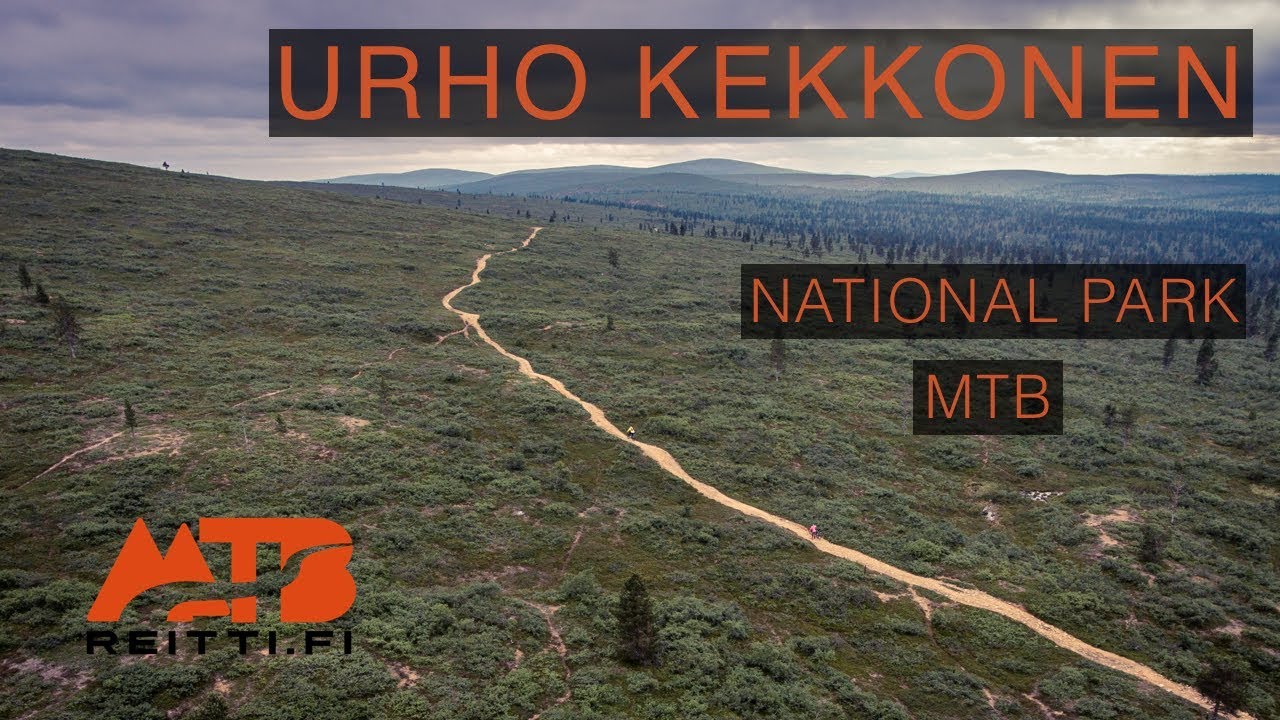
11.7 km
Distance
Roughly one and a half to three hours of pedalling for fit adults on mountain or fat bikes, excluding long stops at Suomen Latu Kiilopää, Sivakkaojan laavu, or Niilanpään porokämppä.
Est. Time
Mixed gravel forest roads and needle-carpeted singletrack typical of easy Kiilopää connectors; short sections can feel softer after rain.
Be the first to write a review for "Sivakkaoja mountain bike route (Niilanpää–Sivakka)"
Share a photo from a recent trip
Answers to your questions
Our data was researched from Sodankylä, and other trusted sources, in March 2026. Our route / place GPX data comes from Metsähallitus / Lipas, last updated March 2026. Always check their official website for safety-critical updates.
Kiilopää's published overview of mountain biking inside Urho Kekkonen National Park—useful for terrain, etiquette, and pacing expectations before heading out, not a turn-by-turn of Sivakkaoja.
Description
For how Open Fell Biking connects Kiilopää with the wider Saariselkä trail spine, how numbered loops and maps are published, and where to download GPX bundles, start with the Municipality of Inari's mountain biking pages. Lapland North Destinations rounds up summer and winter cycling services, rentals, and activity...
Inari.fi – Maastopyöräily Inarissa+
Description
For how Open Fell Biking connects Kiilopää with the wider Saariselkä trail spine, how numbered loops and maps are published, and where to download GPX bundles, start with the Municipality of Inari's mountain biking pages. Lapland North Destinations rounds up summer and winter cycling services, rentals, and activity desks across northernmost Lapland.
Sivakkaoja is a point-to-point ride of about 11.7 km between the Kiilopää service cluster and the Niilanpää area, aimed at riders who want a shorter, approachable leg through forest and gentle furrow terrain rather than a full-day loop. Leaving Kiilopää you quickly pass Kiilopää pysäköintialue, Suomen Latu Kiilopää - Kahvila & Ravintola, Kiilopään frisbeegolfrata, Kiilo-oja tulipaikka, Kiilopään uimapaikka, and Kiilopään Kuurakaltio within a few hundred metres of one another—easy to combine with food, a swim, or equipment rental before you commit to the forest section. Roughly 2.8 km along the line, Sivakkaojan laavu and the nearby Sivakkaoja käymälä make a natural lunch stop in Urho Kekkonen National Park. Further along, about 8 km from the Kiilopää end, Niilanpään porokämppä works as a day-use kota stop with Niilanpään porokämppä tulipaikka, Niilanpää kuivakäymälä, and the surrounding resting spots clustered together.
Independent Saariselkä–Kiilopää outfitters describe the Niilanpää–Sivakka variant as an easy ~13 km ride with modest climbing, mixing gravel-based trails and needle-carpeted forest paths, views toward Kiilopää and Saariselkä from higher ground, and a long mellow descent through old-growth ambiance—useful colour even though the centreline we publish is the slightly shorter mapped geometry. Inside the national park, ride only on posted bicycle corridors and follow Metsähallitus guidance on Luontoon.fi. Kiilopää's own service pages summarise trail courtesy, rentals including full-suspension, fat and e-bikes, wash basics, free e-bike charging, and a broad overview clip of cycling in UKK.
You can extend distance or vary the return by threading into Saariselän maastopyöräilyreitit or the Kiilopää–Luulampi marked options when you want more climbing or hut stops.
Length & route
About 11.7 km point-to-point as the registered trail line between Kiilopää and the Niilanpää area. Regional tour copy often rounds the Niilanpää–Sivakka experience to roughly 13 km with about 100 m of climbing; use our distance for planning and expect modest cumulative ascent similar to other easy Kiilopää legs.
Getting there
Snow-free riding around Kiilopää and Saariselkä typically runs from about June through late October; check municipal and tourism updates before leaving. Start from Kiilopää pysäköintialue or stage a shuttle so you can finish near Niilanpään porokämppä without backtracking. Printed Open Fell Biking maps are distributed free at local businesses and visitor desks, with PDFs and GPX bundles linked from Inari and partner sites.
Good to know
Stay on posted bike corridors inside Urho Kekkonen National Park, yield to walkers and runners where trails are shared, and carry out all litter. Winter networks are maintained separately; do not assume this summer line stays rideable once deep snow arrives. Campfire use at Sivakkaojan laavu follows rescue authorities' fire warnings and everyman's rights constraints.
History
Municipal project pages note EU-funded work that launched the Open Fell Biking identity, published cartography, and expanded cyclist services while Metsähallitus field crews marked Saariselkä cycling routes during summer 2021.
Where to rent bikes
Lapland North Destinations lists rental partners including Kiilopää Adventures at Kiilopää, Saariselkä Ski & Sport Resort, Outdoor Expert Saariselkä, Paadar Aurora Villas, and other activity desks supplying mountain bikes, e-bikes, and fatbikes—book ahead in peak weeks. Roll Outdoors rents full-suspension bikes and fatbikes for the Saariselkä–Kiilopää area when its base is open. Kiilopää's rental desk also offers MTBs, fatbikes, and e-bikes plus helmets and packs.
Guided tours & Experiences
Roll Outdoors and other Lapland North Destinations partners advertise guided mountain bike departures seasonally; check calendars before travel.
Point-to-point as mapped from the Kiilopää service area toward Niilanpää; you can ride either direction or stitch return kilometres via other marked Saariselkä–Kiilopää legs.
Route direction
Open Fell Biking materials describe symbol-and-number posts for loops 1–7 plus a backbone route tying Kakslauttanen, Kiilopää, Saariselkä village, and Moitakuru—carry the latest municipal or tourism PDF map and verify junctions in the field.
Roughly one and a half to three hours of pedalling for fit adults on mountain or fat bikes, excluding long stops at Suomen Latu Kiilopää, Sivakkaojan laavu, or Niilanpään porokämppä.
Est. Time
Mixed gravel forest roads and needle-carpeted singletrack typical of easy Kiilopää connectors; short sections can feel softer after rain.
Be the first to write a review for "Sivakkaoja mountain bike route (Niilanpää–Sivakka)"
Share a photo from a recent trip
Answers to your questions
Our data was researched from Sodankylä, and other trusted sources, in March 2026. Our route / place GPX data comes from Metsähallitus / Lipas, last updated March 2026. Always check their official website for safety-critical updates.