Pyhä-Luosto National Park mountain bike trail (Luosto–Pyhä corridor)
Route
Description
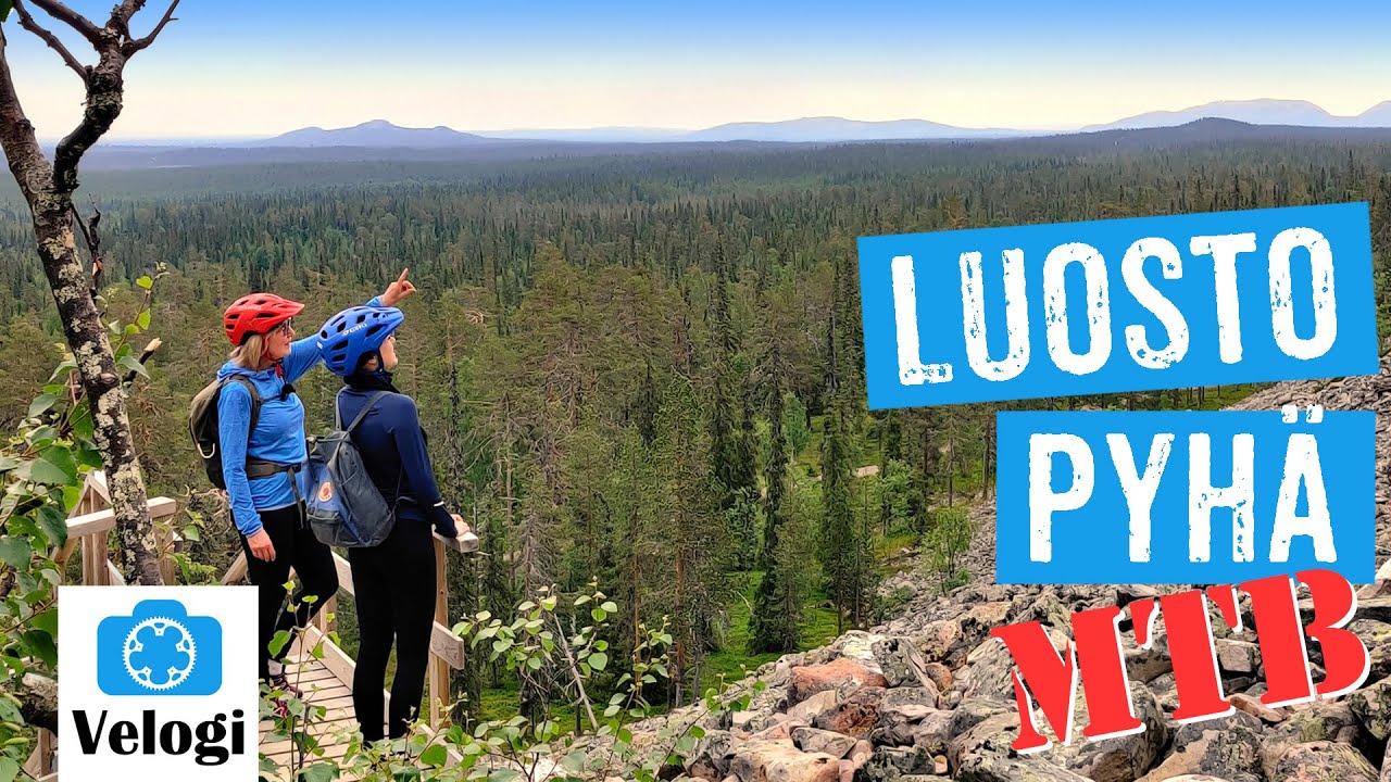
Metsähallitus publishes the Luosto–Pyhä mountain bike corridor as its own trail listing on Luontoon.fi. Luosto.fi describes the ride as an Ice-Age fell chain between the two resorts, mixing old-growth forest, rocky tread, and wider tracks. Pyhä.fi summarises park-scale cycling rules for the snow-free season: stay...
Managed by
Pelkosenniemi
Official Maintenance
Trail info
Most riders travel from Luosto toward Pyhä for longer descents and broader views along the same corridor. Either direction is possible when conditions allow.
Route direction
National Park
Area
Recreation Area
Recreation Area
Lake
Lake
Fell / Mountain
Area
Marked Route
Route Signs
Open / Good Condition
Open / Good Condition
Activities allowed
Hike / Walk
Activity
Bike
Activity
Terrain & conditions
25.4 km
Distance
About 2.5–4.5 hours by mountain bike for fit riders including photo and café stops; add time if you explore Rykimäkero side trails.
Est. Time
Packed gravel and smooth forest track on much of the corridor, with rockier, rootier singletrack sections, short climbs on fell flanks, and occasional ski-base connectors that can feel soft after rain.
Surface
Point-to-Point, Single Track, Wide Track
Route Type
Moderate Traffic
Traffic
Partial Shade
Shade
Location
Rate & Review
Be the first to write a review for "Pyhä-Luosto National Park mountain bike trail (Luosto–Pyhä corridor)"
Share a photo from a recent trip
Answers to your questions
Our data was researched from Pelkosenniemi, and other trusted sources, in March 2026. Our route / place GPX data comes from Metsähallitus / Lipas, last updated March 2026. Always check their official website for safety-critical updates.
Pyhä-Luosto National Park mountain bike trail (Luosto–Pyhä corridor)25.4 km
Route
Video
Videos
Description
Metsähallitus publishes the Luosto–Pyhä mountain bike corridor as its own trail listing on Luontoon.fi. Luosto.fi describes the ride as an Ice-Age fell chain between the two resorts, mixing old-growth forest, rocky tread, and wider tracks. Pyhä.fi summarises park-scale cycling rules for the snow-free season: stay...
Managed by
Pelkosenniemi
Official Maintenance
Trail info
Location
Most riders travel from Luosto toward Pyhä for longer descents and broader views along the same corridor. Either direction is possible when conditions allow.
Route direction
National Park
Area
Recreation Area
Recreation Area
Lake
Lake
Fell / Mountain
Area
Marked Route
Route Signs
Open / Good Condition
Open / Good Condition
Activities allowed
Hike / Walk
Activity
Bike
Activity
Terrain & conditions
25.4 km
Distance
About 2.5–4.5 hours by mountain bike for fit riders including photo and café stops; add time if you explore Rykimäkero side trails.
Est. Time
Packed gravel and smooth forest track on much of the corridor, with rockier, rootier singletrack sections, short climbs on fell flanks, and occasional ski-base connectors that can feel soft after rain.
Surface
Point-to-Point, Single Track, Wide Track
Route Type
Moderate Traffic
Traffic
Partial Shade
Shade
Rate & Review
Be the first to write a review for "Pyhä-Luosto National Park mountain bike trail (Luosto–Pyhä corridor)"
Share a photo from a recent trip
Answers to your questions
Our data was researched from Pelkosenniemi, and other trusted sources, in March 2026. Our route / place GPX data comes from Metsähallitus / Lipas, last updated March 2026. Always check their official website for safety-critical updates.