Jaama Trail / Häikänniemi
Route
Description
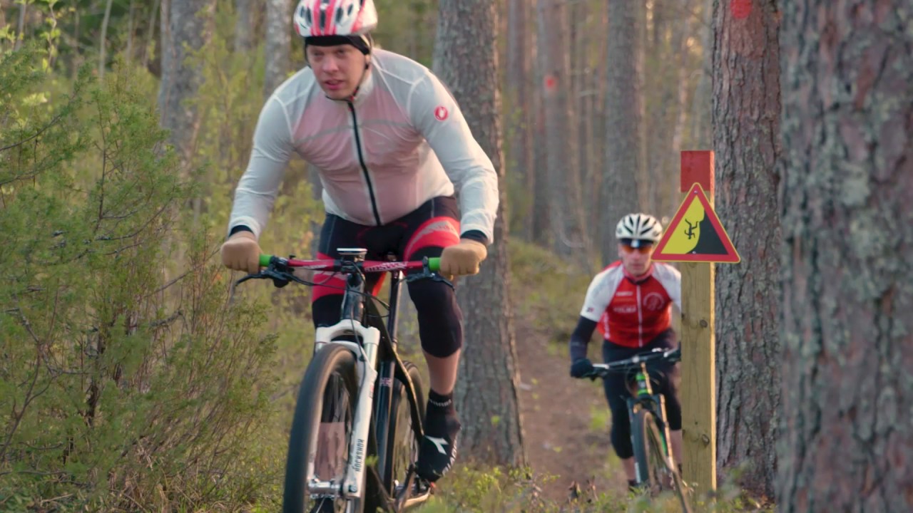
City of Joensuu’s Jaama Trail article on Visit Karelia describes the northern arc of the big orange-marked Jaama ring, including rocky and rooty stretches between the Hirvisärkkä and Häikänniemi branches—only a few hundred metres at a time and walkable beside the bike when needed. Municipality of Kontiolahti explain...
Managed by
Trail info
Point-to-point along the orange Jaama Trail branch toward Häikänniemi; return is typically the same line unless you join longer Jaama or Kontionpolut circuits.
Route direction
Recreation Area
Recreation Area
Lake
Lake
Orange paint blazes on trees and orange-accent wooden signposts on Jaama Trail; Visit Karelia notes map boards along the route and variable guidance in urban sections where a paper map or GPS helps.
Route Signs
Open / Good Condition
Open / Good Condition
Activities allowed
Bike
Activity
Hike / Walk
Activity
Terrain & conditions
1 km
Distance
Often about 10–15 minutes by mountain bike one way before a stop at the beach or fire ring, or roughly 20–30 minutes walking the kilometre.
Est. Time
Narrow forest trail and lake-shore tread typical of Jaama Trail’s northern Pyhäselkä sections; Visit Karelia calls out short rocky and rooty passages in the Hirvisärkkä–Häikänniemi area that demand care when wet.
Surface
Point-to-Point, Single Track
Route Type
Partial Shade
Shade
Light Traffic
Traffic
Location
Rate & Review
Be the first to write a review for "Jaama Trail / Häikänniemi"
Share a photo from a recent trip
Answers to your questions
Our data was researched from Kontiolahti, and other trusted sources, in March 2026. Our route / place GPX data comes from Metsähallitus / Lipas, last updated March 2026. Always check their official website for safety-critical updates.
Jaama Trail / Häikänniemi1 km
Route
Video
Videos
Description
City of Joensuu’s Jaama Trail article on Visit Karelia describes the northern arc of the big orange-marked Jaama ring, including rocky and rooty stretches between the Hirvisärkkä and Häikänniemi branches—only a few hundred metres at a time and walkable beside the bike when needed. Municipality of Kontiolahti explain...
Managed by
Trail info
Location
Point-to-point along the orange Jaama Trail branch toward Häikänniemi; return is typically the same line unless you join longer Jaama or Kontionpolut circuits.
Route direction
Recreation Area
Recreation Area
Lake
Lake
Orange paint blazes on trees and orange-accent wooden signposts on Jaama Trail; Visit Karelia notes map boards along the route and variable guidance in urban sections where a paper map or GPS helps.
Route Signs
Open / Good Condition
Open / Good Condition
Activities allowed
Bike
Activity
Hike / Walk
Activity
Terrain & conditions
1 km
Distance
Often about 10–15 minutes by mountain bike one way before a stop at the beach or fire ring, or roughly 20–30 minutes walking the kilometre.
Est. Time
Narrow forest trail and lake-shore tread typical of Jaama Trail’s northern Pyhäselkä sections; Visit Karelia calls out short rocky and rooty passages in the Hirvisärkkä–Häikänniemi area that demand care when wet.
Surface
Point-to-Point, Single Track
Route Type
Partial Shade
Shade
Light Traffic
Traffic
Rate & Review
Be the first to write a review for "Jaama Trail / Häikänniemi"
Share a photo from a recent trip
Answers to your questions
Our data was researched from Kontiolahti, and other trusted sources, in March 2026. Our route / place GPX data comes from Metsähallitus / Lipas, last updated March 2026. Always check their official website for safety-critical updates.