Koitelinkoski Rapids outdoor trail
Route
Description
For current conditions, closures during large events, firewood deliveries, and services at Koiteli, start with the City of Oulu Koiteli pages. The same recreation area is listed on Luontoon.fi. Visit Oulu summarises the visitor experience for the rapids and islands. Retkipaikka’s walk-through of the Koitelinko...
Managed by
Trail info
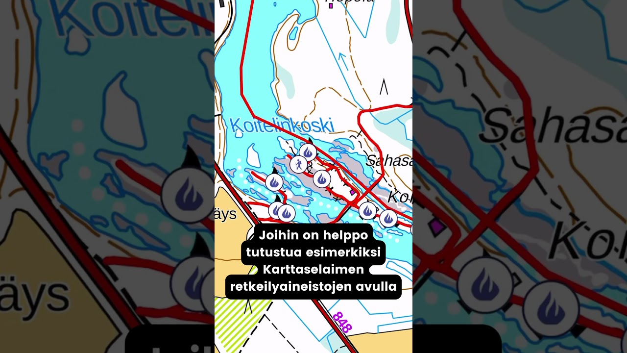
Point-to-point along the mapped segment; the wider Koiteli network offers additional loops and island crossings.
Route direction
Recreation Area
Recreation Area
River
River
Marked Route
Route Signs
Stroller Friendly
Accessibility
Activities allowed
Hike / Walk
Activity
Terrain & conditions
2.1 km
Distance
Allow about 30–45 minutes for the 2.1 km segment at an easy pace with short breaks; exploring the full island network takes longer.
Est. Time
Marked paths with gravel and boardwalk sections in places; some short flights of steps occur, so strollers and assisted wheelchair users need to choose sections with care.
Surface
Point-to-Point, Single Track
Route Type
Partial Shade
Shade
Moderate Traffic
Traffic
2008–2009
Renovation years
Location
Rate & Review
Be the first to write a review for "Koitelinkoski Rapids outdoor trail"
Share a photo from a recent trip
Answers to your questions
Our data was researched from Oulu, and other trusted sources, in March 2026. Our route / place GPX data comes from Metsähallitus / Lipas, last updated March 2026. Always check their official website for safety-critical updates.
Koitelinkoski Rapids outdoor trail2.1 km
Route
Video
Videos
Description
For current conditions, closures during large events, firewood deliveries, and services at Koiteli, start with the City of Oulu Koiteli pages. The same recreation area is listed on Luontoon.fi. Visit Oulu summarises the visitor experience for the rapids and islands. Retkipaikka’s walk-through of the Koitelinko...
Managed by
Trail info
Location
Point-to-point along the mapped segment; the wider Koiteli network offers additional loops and island crossings.
Route direction
Recreation Area
Recreation Area
River
River
Marked Route
Route Signs
Stroller Friendly
Accessibility
Activities allowed
Hike / Walk
Activity
Terrain & conditions
2.1 km
Distance
Allow about 30–45 minutes for the 2.1 km segment at an easy pace with short breaks; exploring the full island network takes longer.
Est. Time
Marked paths with gravel and boardwalk sections in places; some short flights of steps occur, so strollers and assisted wheelchair users need to choose sections with care.
Surface
Point-to-Point, Single Track
Route Type
Partial Shade
Shade
Moderate Traffic
Traffic
2008–2009
Renovation years
Rate & Review
Be the first to write a review for "Koitelinkoski Rapids outdoor trail"
Share a photo from a recent trip
Answers to your questions
Our data was researched from Oulu, and other trusted sources, in March 2026. Our route / place GPX data comes from Metsähallitus / Lipas, last updated March 2026. Always check their official website for safety-critical updates.