Pirkan Taival hiking trail
Route
Description
Pirkan Taival is a long-distance hiking network in northern Pirkanmaa, north of Tampere. Pirkanmaa mixes forests and lakes northwest of Tampere; Virrat lies on this corridor. The City of Virrat describes the wider Pirkan Taival system at about 300 km in total, split into many shorter walking sections, as part of the Eu...
Managed by
Trail info
either direction along this segment; the wider Pirkan Taival network is walked in many configurations
Route direction
Recreation Area
Recreation Area
Lake
Lake
River
River
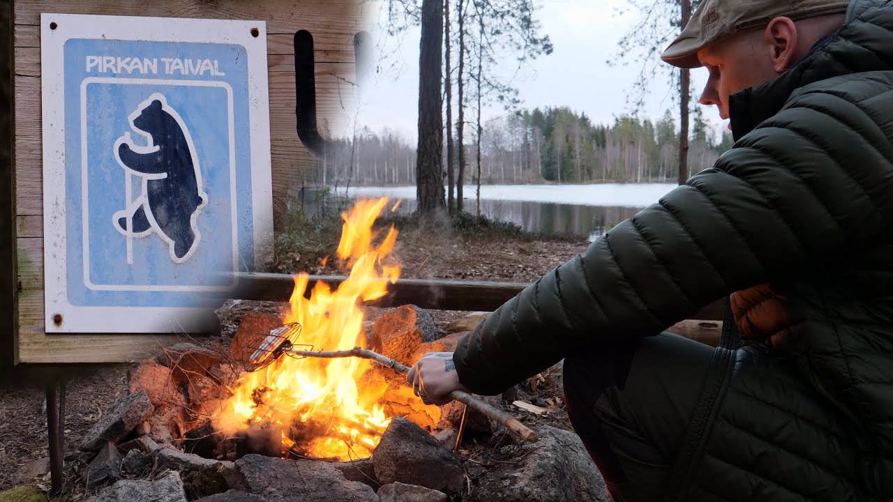
Historic squirrel-disc signage and paint markings remain on parts of the wider Pirkan Taival network; local marking varies by section.
Route Signs
Open / Good Condition
Open / Good Condition
Activities allowed
Hike / Walk
Activity
Terrain & conditions
67 km
Distance
about 3–4 days on foot for this 67 km segment, depending on side trips
Est. Time
Duckboards / Dirt / Gravel
Surface
Point-to-Point, Single Track
Route Type
Light Traffic
Traffic
Partial Shade
Shade
Location
Explore nearby
Rate & Review
Be the first to write a review for "Pirkan Taival hiking trail"
Share a photo from a recent trip
Answers to your questions
Our data was researched from Virrat, and other trusted sources, in March 2026. Our route / place GPX data comes from Metsähallitus / Lipas, last updated March 2026. Always check their official website for safety-critical updates.
Pirkan Taival hiking trail67 km
Route
Video
Videos
Description
Pirkan Taival is a long-distance hiking network in northern Pirkanmaa, north of Tampere. Pirkanmaa mixes forests and lakes northwest of Tampere; Virrat lies on this corridor. The City of Virrat describes the wider Pirkan Taival system at about 300 km in total, split into many shorter walking sections, as part of the Eu...
Managed by
Trail info
Location
either direction along this segment; the wider Pirkan Taival network is walked in many configurations
Route direction
Recreation Area
Recreation Area
Lake
Lake
River
River
Historic squirrel-disc signage and paint markings remain on parts of the wider Pirkan Taival network; local marking varies by section.
Route Signs
Open / Good Condition
Open / Good Condition
Activities allowed
Hike / Walk
Activity
Terrain & conditions
67 km
Distance
about 3–4 days on foot for this 67 km segment, depending on side trips
Est. Time
Duckboards / Dirt / Gravel
Surface
Point-to-Point, Single Track
Route Type
Light Traffic
Traffic
Partial Shade
Shade
Explore nearby
Rate & Review
Be the first to write a review for "Pirkan Taival hiking trail"
Share a photo from a recent trip
Answers to your questions
Our data was researched from Virrat, and other trusted sources, in March 2026. Our route / place GPX data comes from Metsähallitus / Lipas, last updated March 2026. Always check their official website for safety-critical updates.