Vuoksi cycling route
Route

Description
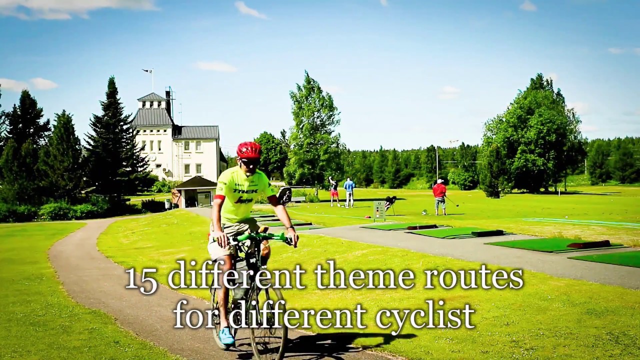
Vuoksi cycling route is an easy, family-friendly ride of about 8 km through central Imatra along the Vuoksi River corridor. It belongs to the batch of fifteen themed cycling products South Karelia rolled out in 2018 for phone and GPS navigation, because the first funding phase paid for catalogue pages and digital track...
Managed by
Trail info
Ride in either direction along the river corridors; regional GPX descriptions often run from Mansikkala toward Imatrankoski, cross Vuoksi, and return along the opposite bank, but you can adapt once you follow your downloaded track.
Route direction
Recreation Area
Recreation Area
Lake
Lake
River
River
Wheelchair Accessible
Accessibility
Stroller Friendly
Accessibility
Open / Good Condition
Open / Good Condition
Activities allowed
Bike
Activity
Terrain & conditions
8 km
Distance
About one to two hours of steady pedalling for the mapped distance without long museum or spa stops; brochures often budget nearer two and a half hours when you read every board and photograph the rapids.
Est. Time
Mostly paved light-traffic paths and streets along Vuoksi with optional finer shore paths; expect short gravel or compacted stretches when you dip closer to the water.
Surface
Point-to-Point, Wide Track
Route Type
Light Traffic
Traffic
Moderate Traffic
Traffic
Partial Shade
Shade
Location
Explore nearby
Rate & Review
Be the first to write a review for "Vuoksi cycling route"
Share a photo from a recent trip
Answers to your questions
Our data was researched from Imatra, and other trusted sources, in March 2026. Our route / place GPX data comes from Metsähallitus / Lipas, last updated March 2026. Always check their official website for safety-critical updates.
Vuoksi cycling route8 km
Route
Video
Videos
Description
Vuoksi cycling route is an easy, family-friendly ride of about 8 km through central Imatra along the Vuoksi River corridor. It belongs to the batch of fifteen themed cycling products South Karelia rolled out in 2018 for phone and GPS navigation, because the first funding phase paid for catalogue pages and digital track...
Managed by
Trail info
Location
Ride in either direction along the river corridors; regional GPX descriptions often run from Mansikkala toward Imatrankoski, cross Vuoksi, and return along the opposite bank, but you can adapt once you follow your downloaded track.
Route direction
Recreation Area
Recreation Area
Lake
Lake
River
River
Wheelchair Accessible
Accessibility
Stroller Friendly
Accessibility
Open / Good Condition
Open / Good Condition
Activities allowed
Bike
Activity
Terrain & conditions
8 km
Distance
About one to two hours of steady pedalling for the mapped distance without long museum or spa stops; brochures often budget nearer two and a half hours when you read every board and photograph the rapids.
Est. Time
Mostly paved light-traffic paths and streets along Vuoksi with optional finer shore paths; expect short gravel or compacted stretches when you dip closer to the water.
Surface
Point-to-Point, Wide Track
Route Type
Light Traffic
Traffic
Moderate Traffic
Traffic
Partial Shade
Shade
Explore nearby
Rate & Review
Be the first to write a review for "Vuoksi cycling route"
Share a photo from a recent trip
Answers to your questions
Our data was researched from Imatra, and other trusted sources, in March 2026. Our route / place GPX data comes from Metsähallitus / Lipas, last updated March 2026. Always check their official website for safety-critical updates.