Kyläniemen kierros is the long South Karelia lake-country loop better known in brochures as the Saimaa Archipelago Route: a multi-day cycling tour around southern Lake Saimaa through Lappeenranta, Imatra, and classic parish villages, with Kyläniemi’s peninsula and ferry crossings as the signature middle act. Saimaa Cyc...
Saimaa Cycling – Saimaa Archipelago Route+
Description
Kyläniemen kierros is the long South Karelia lake-country loop better known in brochures as the Saimaa Archipelago Route: a multi-day cycling tour around southern Lake Saimaa through Lappeenranta, Imatra, and classic parish villages, with Kyläniemi’s peninsula and ferry crossings as the signature middle act. Saimaa Cycling and Visit Lappeenranta publish the route hub, downloadable map, and ferry booking pointers you should read before setting a date. Yle’s two-day field ride captured how blue direction stickers and printed map boards help on the ground—but also noted signage can feel thin in places, so keep the official PDF handy.
On our map the traced line is about 158.7 km as one continuous ride returning toward central Lappeenranta, longer than the 154 km figure some news pieces use because measuring conventions and seasonal detours differ slightly. Expect a mix of high-quality lakeside cycling paths, quieter paved roads, and shorter gravel links—Yle’s reporter hit sudden unpaved segments after Levänen, where scattered blue guidance boards were still enough to stay on course. Long straight stretches on Kantatie 62 toward Ruokolahti carry faster motor traffic; the same report flags narrow shoulders there, so daytime visibility and patience matter.
Water crossings define summer planning: Sarviniemi in Taipalsaari links to Kyläniemi by a bookable bike ferry (advance tickets via the Johku service referenced on Saimaa Cycling and Visit pages), and the free cable ferry at Kyläniemi continues to carry road and cycle traffic across Rastinvirta as described by Finferries. An optional boat hop between Äitsaari and Utula adds a scenic shortcut on posted summer schedules. Outside the main ferry season you can still ride most mainland segments, but you cannot complete the classic island-hop loop the same way.
Culture and nature layer onto the kilometres: Visit Lappeenranta highlights UNESCO Saimaa Geopark sites, Second Salpausselkä ridgelines around Kyläniemi, Huuhanranta’s long sand beach, and Rastinniemi’s campfire shelters a few kilometres beyond Kyläniemi harbour. Approaching Imatra brings national-landscape status at Imatrankoski, outdoor training corners such as Imatrankosken ulkokuntosali along the shore roads, and riverside riding toward Lappeenranta’s harbour boulevard finish. If you want a shorter fortification-themed asphalt alternative that overlaps part of the same shoreline city network, Metsähallitus documents Länsi-Saimaan linnoituskierros separately on Luontoon.fi. Shared city segments can also pass forested rest corners such as Vuorilinnoituksen laavu below Lappeenranta’s fortress hills.
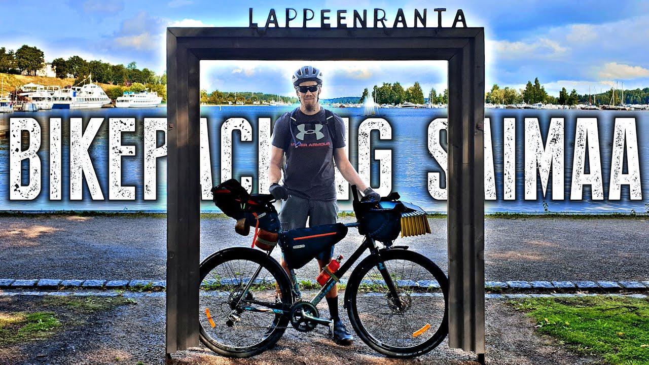
Along the Lappeenranta city legs you pass everyday recreation pockets—Saimaanharjun uimapaikka, nearby outdoor training spots on the same ridge, Louhenpuiston ulkokuntosali near the harbour grid, and Huhmarkallion uimapaikka a little farther out—useful for stretching legs even though they are not the headline Geopark vistas. A Taival Outdoors bikepacking film gives a candid look at ferry queues, lake horizons, and the rhythm of multi-day riding in this basin if you want moving context before you pack panniers.
Length & route
The mapped route is about 158.7 km end to end on huts.fi, bracketing the ~154 km figure journalists cite when they meter only on-bike kilometres without certain ferry segments. Surfaces shift from paved shared paths and municipal streets to rural asphalt, compact gravel legs, and short grit roads toward beaches; Kantatie 62 includes busier truck traffic with a narrow shoulder according to the same field report. Allow spare tubes and tyres suited to light gravel if you insist on road-bike rubber.
Getting there
Saimaa Cycling and Visit Lappeenranta both suggest starting from Lappeenranta harbour or Imatra centre, with VR trains and Matkahuolto coaches feeding both cities. Book bike-ferry slots before you arrive in Sarviniemi; Johku handles reservations tied to Saimaa Cycling’s ferry page. Kyläniemen cable ferry runs on demand—check Finferries’ Kyläniemi pier page for current operating rules.
Good to know
Saimaa Cycling stresses that ferry tickets must always be purchased ahead of time and links printable 2026 map PDFs from the main archipelago article. Visit repeats that overnight camping is not allowed in Sarviniemi harbour because of the adjacent defence force range, and reminds riders to stock food before remote legs between shops. Keep an eye on Saimaa Geopark and municipality notices for construction on Äitsaari detours or Kutveleen canal banks.
History
Visit Lappeenranta recounts how 18th-century Russian military canal building under General Suvorov severed Kyläniemi from the mainland, turning it into an island now reached by modern cable ferry while deep-shipping channels still flow through Rastinvirta. The same Geopark storyline ties Second Salpausselkä bedrock, WWII Salpa Line detours such as the Syyspohja stone barrier near Utula, and rebuilt fortress tourism around Imatra and Lappeenranta.
Itinerary
Day 1 (≈75 km): Roll out from Lappeenranta’s harbour district along lakeside bike paths, pass Saimaanharju services, and follow signed Blue Route alignment toward Taipalsaari. Aim for Sarviniemi in good time for your pre-booked bike ferry to Kyläniemi, then pedal the paved spine to Kyläniemi cable ferry if Ruokolahti is tonight’s goal.
Day 2 (≈80 km): Leave Utula’s village shop after breakfast resupply, ride Kantatie 62 cautiously toward Ruokolahti, dip toward Imatrankoski, and finish along Vuoksi valley cycling links back into Lappeenranta’s waterfront—matching the long second day in Yle’s narrative but adjusting to your own hotel or campsite bookings.
Where to rent bikes
Lappeenranta’s Donkey Republic city bikes are meant for urban hops: Visit Lappeenranta explains unlocking via the mobile app, station map on Digitransit, and links to Kaakau for full price tables (from about one euro for short unlocks up to roughly twelve euros for a day pass on the Kaakau page). That works for connecting trains, harbour spins, or replacing a mechanical—but bring your own trekking or gravel rig for the full 150 km loop and gravel segments.
National media describe blue guidance boards and adhesive trail markers for the Saimaa Archipelago Route, supplemented by printed map boards—still carry the PDF map because coverage is not continuous.
Route Signs
Yle – Field feature on the Saimaa Archipelago Route
Activities allowed
Bike
Activity
Terrain & conditions
158.7 km
Distance
Visit Lappeenranta suggests reserving at least two or three days because of sights, distances, and ferry timing. Yle’s feature ride split roughly 75–80 km per day at touring pace with long evenings for swimming.
Est. Time
Blend of smooth lakeside cycleways, rural asphalt, lightly trafficked parish roads, short coarse gravel links toward beaches and headlands, and a higher-speed shoulder ride on Kantatie 62 where heavy vehicles appear in travel journalism.
Be the first to write a review for "Kyläniemen kierros – Saimaa Archipelago touring circuit"
Share a photo from a recent trip
Answers to your questions
Our data was researched from Lappeenranta, and other trusted sources, in March 2026. Our route / place GPX data comes from Metsähallitus / Lipas, last updated March 2026. Always check their official website for safety-critical updates.
Taival Outdoors’ half-hour bikepacking film follows a three-day Saimaa Archipelago Route lap with ferries, lakeside camping rhythm, and South Karelia town stops—useful mood reference for how water crossings pace the tour.
Description
Kyläniemen kierros is the long South Karelia lake-country loop better known in brochures as the Saimaa Archipelago Route: a multi-day cycling tour around southern Lake Saimaa through Lappeenranta, Imatra, and classic parish villages, with Kyläniemi’s peninsula and ferry crossings as the signature middle act. Saimaa Cyc...
Saimaa Cycling – Saimaa Archipelago Route+
Description
Kyläniemen kierros is the long South Karelia lake-country loop better known in brochures as the Saimaa Archipelago Route: a multi-day cycling tour around southern Lake Saimaa through Lappeenranta, Imatra, and classic parish villages, with Kyläniemi’s peninsula and ferry crossings as the signature middle act. Saimaa Cycling and Visit Lappeenranta publish the route hub, downloadable map, and ferry booking pointers you should read before setting a date. Yle’s two-day field ride captured how blue direction stickers and printed map boards help on the ground—but also noted signage can feel thin in places, so keep the official PDF handy.
On our map the traced line is about 158.7 km as one continuous ride returning toward central Lappeenranta, longer than the 154 km figure some news pieces use because measuring conventions and seasonal detours differ slightly. Expect a mix of high-quality lakeside cycling paths, quieter paved roads, and shorter gravel links—Yle’s reporter hit sudden unpaved segments after Levänen, where scattered blue guidance boards were still enough to stay on course. Long straight stretches on Kantatie 62 toward Ruokolahti carry faster motor traffic; the same report flags narrow shoulders there, so daytime visibility and patience matter.
Water crossings define summer planning: Sarviniemi in Taipalsaari links to Kyläniemi by a bookable bike ferry (advance tickets via the Johku service referenced on Saimaa Cycling and Visit pages), and the free cable ferry at Kyläniemi continues to carry road and cycle traffic across Rastinvirta as described by Finferries. An optional boat hop between Äitsaari and Utula adds a scenic shortcut on posted summer schedules. Outside the main ferry season you can still ride most mainland segments, but you cannot complete the classic island-hop loop the same way.
Culture and nature layer onto the kilometres: Visit Lappeenranta highlights UNESCO Saimaa Geopark sites, Second Salpausselkä ridgelines around Kyläniemi, Huuhanranta’s long sand beach, and Rastinniemi’s campfire shelters a few kilometres beyond Kyläniemi harbour. Approaching Imatra brings national-landscape status at Imatrankoski, outdoor training corners such as Imatrankosken ulkokuntosali along the shore roads, and riverside riding toward Lappeenranta’s harbour boulevard finish. If you want a shorter fortification-themed asphalt alternative that overlaps part of the same shoreline city network, Metsähallitus documents Länsi-Saimaan linnoituskierros separately on Luontoon.fi. Shared city segments can also pass forested rest corners such as Vuorilinnoituksen laavu below Lappeenranta’s fortress hills.
Along the Lappeenranta city legs you pass everyday recreation pockets—Saimaanharjun uimapaikka, nearby outdoor training spots on the same ridge, Louhenpuiston ulkokuntosali near the harbour grid, and Huhmarkallion uimapaikka a little farther out—useful for stretching legs even though they are not the headline Geopark vistas. A Taival Outdoors bikepacking film gives a candid look at ferry queues, lake horizons, and the rhythm of multi-day riding in this basin if you want moving context before you pack panniers.
Length & route
The mapped route is about 158.7 km end to end on huts.fi, bracketing the ~154 km figure journalists cite when they meter only on-bike kilometres without certain ferry segments. Surfaces shift from paved shared paths and municipal streets to rural asphalt, compact gravel legs, and short grit roads toward beaches; Kantatie 62 includes busier truck traffic with a narrow shoulder according to the same field report. Allow spare tubes and tyres suited to light gravel if you insist on road-bike rubber.
Getting there
Saimaa Cycling and Visit Lappeenranta both suggest starting from Lappeenranta harbour or Imatra centre, with VR trains and Matkahuolto coaches feeding both cities. Book bike-ferry slots before you arrive in Sarviniemi; Johku handles reservations tied to Saimaa Cycling’s ferry page. Kyläniemen cable ferry runs on demand—check Finferries’ Kyläniemi pier page for current operating rules.
Good to know
Saimaa Cycling stresses that ferry tickets must always be purchased ahead of time and links printable 2026 map PDFs from the main archipelago article. Visit repeats that overnight camping is not allowed in Sarviniemi harbour because of the adjacent defence force range, and reminds riders to stock food before remote legs between shops. Keep an eye on Saimaa Geopark and municipality notices for construction on Äitsaari detours or Kutveleen canal banks.
History
Visit Lappeenranta recounts how 18th-century Russian military canal building under General Suvorov severed Kyläniemi from the mainland, turning it into an island now reached by modern cable ferry while deep-shipping channels still flow through Rastinvirta. The same Geopark storyline ties Second Salpausselkä bedrock, WWII Salpa Line detours such as the Syyspohja stone barrier near Utula, and rebuilt fortress tourism around Imatra and Lappeenranta.
Itinerary
Day 1 (≈75 km): Roll out from Lappeenranta’s harbour district along lakeside bike paths, pass Saimaanharju services, and follow signed Blue Route alignment toward Taipalsaari. Aim for Sarviniemi in good time for your pre-booked bike ferry to Kyläniemi, then pedal the paved spine to Kyläniemi cable ferry if Ruokolahti is tonight’s goal.
Day 2 (≈80 km): Leave Utula’s village shop after breakfast resupply, ride Kantatie 62 cautiously toward Ruokolahti, dip toward Imatrankoski, and finish along Vuoksi valley cycling links back into Lappeenranta’s waterfront—matching the long second day in Yle’s narrative but adjusting to your own hotel or campsite bookings.
Where to rent bikes
Lappeenranta’s Donkey Republic city bikes are meant for urban hops: Visit Lappeenranta explains unlocking via the mobile app, station map on Digitransit, and links to Kaakau for full price tables (from about one euro for short unlocks up to roughly twelve euros for a day pass on the Kaakau page). That works for connecting trains, harbour spins, or replacing a mechanical—but bring your own trekking or gravel rig for the full 150 km loop and gravel segments.
National media describe blue guidance boards and adhesive trail markers for the Saimaa Archipelago Route, supplemented by printed map boards—still carry the PDF map because coverage is not continuous.
Route Signs
Yle – Field feature on the Saimaa Archipelago Route
Visit Lappeenranta suggests reserving at least two or three days because of sights, distances, and ferry timing. Yle’s feature ride split roughly 75–80 km per day at touring pace with long evenings for swimming.
Est. Time
Blend of smooth lakeside cycleways, rural asphalt, lightly trafficked parish roads, short coarse gravel links toward beaches and headlands, and a higher-speed shoulder ride on Kantatie 62 where heavy vehicles appear in travel journalism.
Be the first to write a review for "Kyläniemen kierros – Saimaa Archipelago touring circuit"
Share a photo from a recent trip
Answers to your questions
Our data was researched from Lappeenranta, and other trusted sources, in March 2026. Our route / place GPX data comes from Metsähallitus / Lipas, last updated March 2026. Always check their official website for safety-critical updates.