Kontionpolut / Välilampi Trail
Route
Description
For yellow waymarking, firewood at the lean-to, driving directions to Taskisentie and Palokankaantie parking, and how this ring links to green Salpalinja, blue Stadium, and orange Jaama Trail arms, start from Visit Karelia’s Välilampi Trail article. Municipality of Kontiolahti publishes the downloadable Kontionpolut...
Managed by
Trail info
Visit Karelia describes the yellow ring as passable in either direction.
Route direction
Recreation Area
Recreation Area
Lake
Lake
Yellow paint in the forest and matching yellow information on signboards for the Välilampi circuit; use the Kontionpolut colour key on Visit Karelia to see how yellow links beside green Salpalinja, blue Stadium, and orange Jaama Trail segments.
Route Signs
Open / Good Condition
Open / Good Condition
Activities allowed
Run
Activity
Hike / Walk
Activity
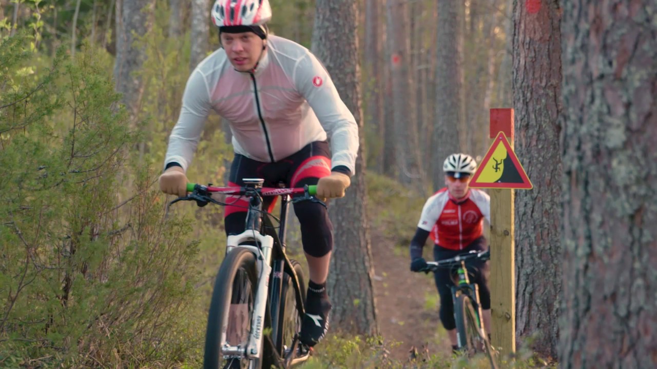
Bike
Activity
Terrain & conditions
10.9 km
Distance
Often about 1–2 hours by mountain bike for the 10.9 km line on this page, or longer if you follow the full ~13.5 km yellow circuit described in municipal materials; hikers and runners typically need more time.
Est. Time
Mixed forest paths, winding singletrack, and intermittent wider forest roads or sand segments typical of Jaamankangas esker terrain.
Surface
Point-to-Point, Single Track
Route Type
Moderate Traffic
Traffic
Partial Shade
Shade
Location
Explore nearby
Rate & Review
Be the first to write a review for "Kontionpolut / Välilampi Trail"
Share a photo from a recent trip
Answers to your questions
Our data was researched from Kontiolahti, and other trusted sources, in March 2026. Our route / place GPX data comes from Metsähallitus / Lipas, last updated March 2026. Always check their official website for safety-critical updates.
Kontionpolut / Välilampi Trail10.9 km
Route
Video
Videos
Description
For yellow waymarking, firewood at the lean-to, driving directions to Taskisentie and Palokankaantie parking, and how this ring links to green Salpalinja, blue Stadium, and orange Jaama Trail arms, start from Visit Karelia’s Välilampi Trail article. Municipality of Kontiolahti publishes the downloadable Kontionpolut...
Managed by
Trail info
Location
Visit Karelia describes the yellow ring as passable in either direction.
Route direction
Recreation Area
Recreation Area
Lake
Lake
Yellow paint in the forest and matching yellow information on signboards for the Välilampi circuit; use the Kontionpolut colour key on Visit Karelia to see how yellow links beside green Salpalinja, blue Stadium, and orange Jaama Trail segments.
Route Signs
Open / Good Condition
Open / Good Condition
Activities allowed
Run
Activity
Hike / Walk
Activity
Bike
Activity
Terrain & conditions
10.9 km
Distance
Often about 1–2 hours by mountain bike for the 10.9 km line on this page, or longer if you follow the full ~13.5 km yellow circuit described in municipal materials; hikers and runners typically need more time.
Est. Time
Mixed forest paths, winding singletrack, and intermittent wider forest roads or sand segments typical of Jaamankangas esker terrain.
Surface
Point-to-Point, Single Track
Route Type
Moderate Traffic
Traffic
Partial Shade
Shade
Explore nearby
Rate & Review
Be the first to write a review for "Kontionpolut / Välilampi Trail"
Share a photo from a recent trip
Answers to your questions
Our data was researched from Kontiolahti, and other trusted sources, in March 2026. Our route / place GPX data comes from Metsähallitus / Lipas, last updated March 2026. Always check their official website for safety-critical updates.